Space Coast Commute Map: Every City to KSC, Patrick, Orlando and MCO
Space Coast Commute Map: Every City to KSC, Patrick, Orlando and MCO
Ten Brevard County cities, four destinations most people are solving for, and the roads, bridges and closures that decide the drive — corridor by corridor, with no invented minute counts.
Ask how far it is from a Space Coast address to work and somebody will hand you a number. The number will be wrong the first morning you drive it. Brevard County is long and narrow, strung between Interstate 95 on the mainland and State Road A1A on the barrier island, with a short list of causeways stitching the two together and a federal reservation at the top that closes roads on its own schedule. What governs your drive is which bridge you cross, which gate your badge opens, and whether a launch window sits on the calendar. So I build relocation searches around corridors, and I treat any minute count as a guess until the buyer has driven it at their real hour.
This is the map I wish somebody had drawn for me the first time I moved a family into Brevard. Every city we work in gets its roads named, its constraints stated, and a link to its own page so you can see the housing stock on that corridor. If you are earlier than this, start with the relocation overview for the Space Coast and come back once you know where the job is. The honest headline first: no city in this county is close to all four destinations below. You are choosing which drive you accept.
Why minutes are the wrong unit here
Three things about Brevard County make a published minute count less useful than it looks, and all three are structural.
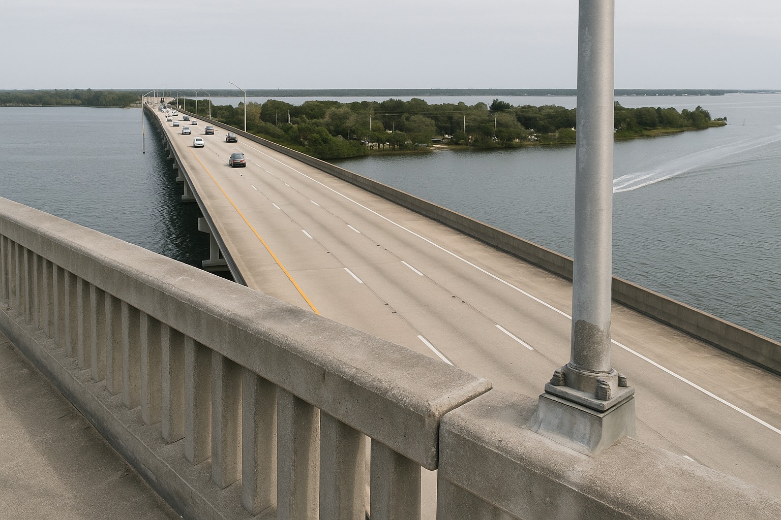
Bridges. Almost every trip between the mainland and the barrier island uses one of a handful of causeways — SR 528, SR 520, SR 404, SR 518, SR 192 — and each is a chokepoint with no parallel a mile away. On the mainland, a crash on Interstate 95 leaves you US 1. On a causeway there is nothing until the next crossing, which may be miles up or down the shoreline. That is a different risk than distance, and no map app prices it for you on a quiet Sunday.
Federal schedules. The north end of the county belongs to NASA's Kennedy Space Center and to Cape Canaveral Space Force Station. Access past the security gates is badge or ticket only, launch operations can close public roads and beaches on their own timing, and the schedule slips constantly. A commute beside that reservation carries a variable a mainland office park does not.
Tolls and volume. The Beachline, SR 528, is the road almost everyone uses to reach Orlando and the airport, and it is a toll facility. Operating responsibility along its length is split between Florida's Turnpike Enterprise and the Central Florida Expressway Authority, so confirm current toll and transponder rules with the authority for the segment you would drive. Meanwhile I-95 through central Brevard carries regional traffic that has nothing to do with your morning.
The one-line version
Pick the corridor first, then pick the house. In Brevard County the durable fact is which roads and bridges a property forces you onto every day. Minute counts change with the season, the crash, the launch and the lane closure — the corridor does not.
The four destinations most people are solving for
Nearly every relocation conversation I have on the Space Coast resolves to one of four workplaces, and they sit at genuinely different ends of the county.
Kennedy Space Center and Cape Canaveral Space Force Station. These occupy the northern end of Merritt Island and the shoreline east of it. Two approaches serve them: SR 405, the NASA Causeway, reached from Titusville and from I-95 via SR 407, and SR 3, the Courtenay Parkway, running north up Merritt Island. Which one you use depends on your gate rather than your address, and your employer is the only reliable source for that. See the arrangement of land and water around the KSC causeway approaches on a map.
Patrick Space Force Base. This one surprises people, because it is not near the Cape at all. Patrick Space Force Base sits on the barrier island itself, on A1A between Cocoa Beach and Satellite Beach, with the Atlantic on one side and the Banana River on the other. If Patrick is your workplace, the barrier island south of Cocoa Beach and the mainland end of the Pineda Causeway are the two search areas that make sense, and north Brevard largely does not. Find it at Patrick SFB on A1A.
The Melbourne employment core. South Brevard is where the county's private aerospace, defense, health-system and university employers cluster, around Melbourne, West Melbourne and Melbourne Orlando International Airport. I break that core down employer by employer and corridor by corridor in the Melbourne employment map. The short version: if you work there, the county's southern half is your search area and the northern half is a long daily drive.
Orlando and MCO. For airport runs or a hybrid role with an Orlando office, SR 528 is the road. From Titusville, SR 50 west is the alternative. Everything else funnels onto I-95 first and then west onto the Beachline. Orlando International Airport is the destination most buyers underestimate, because they picture the drive on an empty road and then meet it on a Friday.
North county: Titusville, Merritt Island and Cape Canaveral
Titusville sits on the west bank of the Indian River Lagoon at the top of the county, and its road set is unusually legible. US 1 is the spine along the water. I-95 runs several miles west with the interchanges that carry you toward Orlando or south through Brevard. SR 405, the NASA Causeway, is the eastern crossing onto Kennedy Space Center, fed from the interstate by SR 407, the Challenger Memorial Parkway. Head northeast instead and SR 406, the Max Brewer Memorial Parkway, carries you into the Merritt Island National Wildlife Refuge. West, SR 50 runs to Orlando. If your work is at KSC, this is the simplest drive in the county. If your work is in Melbourne, it is the longest. The Titusville area guide covers the housing stock along those corridors, and living under the launch path goes deeper on closures and sonic booms.
Merritt Island is the only place in Brevard that touches KSC by road without crossing a bridge. SR 3, the Courtenay Parkway, runs the length of the island north into the space center; SR 520 crosses west to Cocoa and east to Cocoa Beach; SR 528 crosses the north end and continues over the Bennett Causeway into Cape Canaveral; SR 404, the Pineda Causeway, ties the south end to the Viera and Suntree side of the mainland and onward to A1A. The Canaveral Barge Canal splits the island east to west, which matters because the crossings over it become the local chokepoints. At the far south tip, Mathers Bridge is a narrow swing span to Indian Harbour Beach — confirm its condition and any restrictions with Brevard County before you build a daily commute on it. See the Merritt Island guide and the causeway commute breakdown.
Cape Canaveral is the barrier-island city immediately north of Cocoa Beach, with A1A running through it and SR 401 branching east through Port Canaveral toward the Space Force station's south gate. Its structural advantage is SR 528: from here you reach the Beachline almost immediately, which makes Orlando and the airport a straighter shot than from anywhere else on the island. Its cost is cruise-ship and port traffic on port days, plus launch-related closures on the roads nearest the station. The Cape Canaveral guide lays out what that buys you in housing.
Central: Cocoa Beach, Rockledge and Viera
Cocoa Beach runs north to south on A1A with the Atlantic on one side and the Banana River on the other, and the one through road is most of the story. West, SR 520 is your crossing to Merritt Island, Cocoa and I-95. North, A1A carries you into Cape Canaveral and onto SR 528. South, A1A takes you past Patrick Space Force Base toward Satellite Beach. For a Patrick or Cape assignment, that is a strong position. For a Melbourne job it is a long barrier-island run or an inland detour to the interstate. Read the Cocoa Beach buyer's guide, and if you are still weighing island against mainland at all, beachside versus mainland Brevard is the post that settles it for most people.
Rockledge is a mainland city on the west bank of the Indian River Lagoon, just south of Cocoa, and its commuting profile is the quiet one people overlook. US 1 and the historic riverfront of Rockledge Drive sit along the water; Fiske Boulevard and Barnes Boulevard run the interior grid; I-95 is close, with SR 520 and Barnes Boulevard as the usual approaches. Because Rockledge sits on the mainland side of the lagoon, no daily crossing is required for I-95, SR 528 or the Melbourne corridor. That is why I raise it with buyers who work at opposite ends of the county. The Rockledge community guide has the housing detail.
Viera straddles I-95 in central Brevard, which is the most useful sentence anybody can tell you about it. Wickham Road, Viera Boulevard, Stadium Parkway and Murrell Road move traffic locally, and the Pineda Causeway Extension connects the community west to the interstate and east across SR 404 toward Merritt Island and the beaches. From here, both ends of the county are reachable and neither is close. That is the trade. Viera has an area guide and current Viera listings on this site; if you are comparing it against south Brevard, Palm Bay versus Viera runs the numbers side by side.
South: Melbourne, the beaches and Palm Bay
Melbourne is where the road network stops being about bridges and starts being about arterials. I-95 and US 1 run north to south; Wickham Road, Babcock Street, Sarno Road and Eau Gallie Boulevard carry the interior; SR 518, the Eau Gallie Causeway, and SR 192, the Melbourne Causeway, cross the lagoon to the barrier island. Melbourne Orlando International Airport sits inside the city, which changes the calculation for anyone who flies weekly. If the employment core is your destination, living in it removes a causeway from your day — see the Melbourne guide.
Satellite Beach and the barrier island south of Patrick are the tightest fit for a Patrick Space Force Base assignment, because A1A delivers you north to the gate without a bridge. Off the island, SR 404 crosses west toward Viera and the interstate and SR 518 crosses toward Eau Gallie and Melbourne. Two crossings, both usable, neither redundant. The Satellite Beach guide covers the housing stock between the ocean and the river.
Melbourne Beach is the honest downside case on this page, and I say so to every buyer who falls for it. South of the SR 192 causeway, A1A is the only road. There is no parallel route, no second bridge for a long stretch, and anything that closes the highway closes your way home. People who live there accept that in exchange for a narrow, quiet stretch of barrier island between the Atlantic and the lagoon. Go in with your eyes open; the Melbourne Beach guide is straight about it.
Palm Bay is the county's southern anchor and its largest city by land area, with I-95 interchanges at Palm Bay Road and Malabar Road, Babcock Street running north into Melbourne, Emerson Drive and Minton Road serving the interior, and the newer St. Johns Heritage Parkway opening up the western side. Everything north of Melbourne is a genuine drive from here. Everything in the Melbourne employment core is close. If your work is at the Cape, be honest with yourself about the length of that commute before you sign. The Palm Bay area guide covers what the road access means for the housing.
Brianna's take
When two people in a household work at opposite ends of Brevard, the answer is almost always central and mainland — Rockledge, Viera, or the Suntree side of Melbourne — because those places put both drives on I-95 without a causeway in either one. It is nobody's shortest commute and it is nobody's disaster. I would rather give a couple two acceptable drives than give one person a very short trip and the other a daily grind they quit within a year.
The routes table: what governs the drive from each city
Read this as a map of corridors and constraints. It carries no minute counts, because the only honest one is the number you measure yourself on the road you would really drive.
| City | Roads you will use | What governs the drive |
|---|---|---|
| Titusville homes for sale · market snapshot | US 1, I-95, SR 405 (NASA Causeway), SR 407, SR 406, SR 50 | Closest approach to Kennedy Space Center; gate assignment decides the route. Launch-day closures and viewing traffic near the riverfront. Longest drive in the county to Melbourne. |
| Merritt Island island listings · island market data | SR 3 (Courtenay Pkwy), SR 520, SR 528, SR 404 (Pineda), Mathers Bridge | Reaches KSC without a bridge via SR 3. Barge-canal crossings are the internal chokepoints. North island and south island are effectively two different commutes. |
| Cape Canaveral Cape Canaveral homes · Cape market report | A1A, SR 401, SR 528 (Bennett Causeway) | Fastest access to the Beachline of any barrier-island city. Port and cruise-day traffic on SR 401; launch closures near the Space Force station. |
| Cocoa Beach oceanfront listings · Cocoa Beach market | A1A, SR 520 (Cocoa Beach Causeway) | A1A is the only continuous through road north to south. SR 520 is the single western crossing. Beach and event traffic in season. Strong for Patrick and the Cape, long to Melbourne. |
| Rockledge Rockledge properties · Rockledge market trends | US 1, Rockledge Dr, Fiske Blvd, Barnes Blvd, I-95, SR 520 | Mainland position means no causeway for I-95, SR 528 or the Melbourne corridor. Central enough to serve both ends of the county without favoring either. |
| Viera Viera homes (no market page) | I-95, Wickham Rd, Viera Blvd, Stadium Pkwy, Murrell Rd, SR 404 / Pineda Extension | Straddles the interstate, so both directions open equally. The Pineda is the eastern crossing to Merritt Island and the beaches. Neither end of the county is close. |
| Melbourne Melbourne listings · Melbourne market snapshot | I-95, US 1, Wickham Rd, Babcock St, Sarno Rd, SR 518, SR 192 | Inside the county's employment core, so the commute is arterial rather than causeway-dependent. Melbourne Orlando International Airport is in the city. |
| Satellite Beach Satellite Beach homes · Satellite Beach market | A1A, SR 404 (Pineda Causeway), SR 518 (Eau Gallie Causeway) | Bridge-free run north on A1A to Patrick Space Force Base. Two western crossings, and every mainland trip uses one of them. |
| Melbourne Beach beachside listings · Melbourne Beach market data | A1A, SR 192 (Melbourne Causeway) | A1A is the only road south of the causeway. No parallel route and no second crossing for a long stretch — a highway closure closes your way home. |
| Palm Bay Palm Bay homes for sale · Palm Bay market report | I-95 (Palm Bay Rd, Malabar Rd), Babcock St, Minton Rd, Emerson Dr, St. Johns Heritage Pkwy | Southernmost of the ten, so every northbound destination adds distance. Close to the Melbourne core; a long haul to KSC and the Cape. |
Corridor and route information summarized from the Florida Department of Transportation's state road designations, NASA Kennedy Space Center, the United States Space Force, the Canaveral Port Authority, and Brevard County and municipal road records, as of August 2026. Road configurations, bridge status and access rules change — confirm conditions with the managing agency before relying on a route.
Drive it at your real hour before you buy
This is the part of the process I refuse to shortcut, and it costs a buyer one Tuesday. Here is the order I run it in.
- Ask which entrance your badge opens before you ask about the address. For anyone working at Kennedy Space Center, Cape Canaveral Space Force Station or Patrick Space Force Base, the gate your badge opens changes the route more than the neighborhood does. Get that answer from your employer before you tour a single house.
- Drive it twice, inbound and outbound, at your actual start and end times. Shift work here does not follow ordinary rush hour. A road that is empty before dawn is a different road at four in the afternoon.
- Count the bridges. Write down every causeway or movable span the route uses. One crossing with no alternative is a fact you should know before closing, not after.
- Check the traveler information first. Florida DOT publishes live conditions, construction and incidents at FL511, and its project pages at the Florida Department of Transportation show what is scheduled on your corridor.
- Look at the launch schedule for that week. If your route touches north Merritt Island, Port Canaveral or the beachside roads near the Space Force station, drive it once on a launch day and once on an ordinary day. Both are your life now.
- Price the tolls into the monthly budget. A Beachline commute is a recurring cost, and it belongs in the same column as insurance and taxes. I walk through the whole carrying-cost picture in the Space Coast cost-of-living breakdown.
- Solve the second commute too. If two people are driving, map both before you narrow the search. A house that is perfect for one driver and punishing for the other is a countdown.
Once you have driven the routes, the shortlist usually collapses on its own. If it does not, the town-by-town decision guide is the next thing to read, and the mortgage calculator will price a corridor you like before you commit to it.
Frequently asked questions
How long is the commute from each Space Coast city to Kennedy Space Center?
I will not publish a minute count, because the honest answer depends on your gate, your shift and the day rather than on the city name. What is fixed is the route. Titusville reaches Kennedy Space Center by SR 405, the NASA Causeway, fed from Interstate 95 by SR 407. Merritt Island reaches it by SR 3, the Courtenay Parkway, without crossing a bridge. Cape Canaveral and Cocoa Beach approach from the south and east through the Space Force station road network. Everywhere south of Cocoa uses Interstate 95 or US 1 for most of the distance. Ask your employer which gate your badge opens, then drive that route twice at your real start and end times.
What is the fastest route from the Space Coast to Orlando International Airport?
For almost every Brevard County city the road is SR 528, the Beachline Expressway, which runs west from Cape Canaveral and Merritt Island across the mainland toward Orlando International Airport. From Titusville, SR 50 west is the common alternative. From the southern cities you generally take Interstate 95 north first and then turn west onto SR 528. The Beachline is a toll facility with operating responsibility split between Florida's Turnpike Enterprise and the Central Florida Expressway Authority, so confirm current toll and transponder rules with the authority that operates the segment you would drive.
Which Space Coast cities are closest to Patrick Space Force Base?
Patrick Space Force Base sits on the barrier island itself, on A1A between Cocoa Beach and Satellite Beach, which surprises people who assume it is near the Cape. Satellite Beach and the surrounding barrier island run north to the base on A1A without crossing a bridge. Cocoa Beach approaches from the north on the same road. On the mainland, the Melbourne, Suntree and Viera side reaches it across SR 404, the Pineda Causeway, or SR 518, the Eau Gallie Causeway. North Brevard is a long daily drive to Patrick and I say so plainly to buyers who ask.
Do rocket launches close roads and affect commutes in Brevard County?
They can, and the effect is concentrated in the north of the county. Access past the security gates at Kennedy Space Center and Cape Canaveral Space Force Station is badge or ticket only at all times, and launch operations can close public roads, beaches and refuge access on their own schedule. High-profile launches also draw viewing crowds to the Titusville riverfront, the Port Canaveral area and the beachside roads. Ordinary overnight cargo launches often change nothing at all. Launch dates slip constantly, so check the managing agency the morning of any attempt rather than relying on an earlier announcement.
Is living on the barrier island harder for commuting than the mainland?
It is more constrained, which is a different thing from harder. The barrier island runs on A1A with a limited set of causeways crossing west, so any mainland trip uses one of those crossings and there is rarely a parallel route if one closes. Melbourne Beach is the clearest case, because A1A is the only road south of the SR 192 causeway. Against that, an island address can be the shortest possible commute if your work is at Patrick Space Force Base or in the Cape Canaveral corridor. The real question is which crossings your specific commute depends on.
Which Space Coast city works best if two people work at opposite ends of the county?
Central and mainland is usually the answer. Rockledge, Viera and the Suntree side of Melbourne sit close to Interstate 95 without requiring a causeway crossing in either direction, so both drives run on the same spine and neither person is stranded behind a bridge. Neither drive will be the shortest one available in the county, and neither will be the one that breaks somebody. That trade is usually what keeps both people in the house past year two.
Do I need a toll transponder to commute on the Space Coast?
It depends entirely on your route. The everyday county roads, Interstate 95, US 1, A1A and the causeways within Brevard are not toll facilities, so a purely in-county commute may never touch a toll. SR 528, the Beachline, is the toll road most Space Coast residents use to reach Orlando and the airport, and if that is part of your regular week the tolls belong in your monthly budget alongside insurance and taxes. Confirm the current rates and transponder options with the authority operating the segment you would use, since responsibility along SR 528 is shared.
How should I test a Space Coast commute before I buy a home?
Ask your employer which entrance or gate you will use, then drive the route twice on a working day, once inbound at your real start time and once outbound at your real end time. Write down every causeway or movable bridge the route depends on. Check live conditions and scheduled construction through Florida DOT's FL511 service and the department's project pages. If the route touches north Merritt Island or the beachside roads near the Space Force station, drive it once on a launch day as well. Then map the second driver in the household before you narrow the search.
Keep reading
Not sure which corridor your job really puts you on?
Tell me where you will be working and what hours you keep, and I will tell you which Space Coast corridors deserve your search — and which will wear you out by year two. I have served Space Coast clients since 2015, and I would rather talk you out of the wrong end of the county than sell you a house on it.
Data last verified: August 2026. Route, corridor and access information summarized from the Florida Department of Transportation (including its FL511 traveler information service), NASA Kennedy Space Center, the United States Space Force (Patrick Space Force Base and Cape Canaveral Space Force Station), the Canaveral Port Authority, and Brevard County and municipal road records, as of August 2026. This page deliberately contains no drive-time estimates. Road configurations, bridge status, toll rates and closures change without notice — confirm conditions with the managing agency, and drive the route yourself at your real commuting hour.
Categories
- All Blogs (48)
- Cost of Living (3)
- Cost of Ownership (25)
- Decision Guide (9)
- Living in Cape Canaveral (8)
- Living in Cocoa Beach (5)
- Living in Melbourne (4)
- Living in Melbourne Beach (5)
- Living in Palm Bay (4)
- Living in Rockledge (3)
- Living in Satellite Beach (6)
- Living in Titusville (6)
- Living in Viera (4)
- Living on Merritt Island (4)
- When Buying (4)
- When Relocating (7)
Recent Posts