Living Under the Launch Path: Titusville, KSC and Launch-Day Reality
Living Under the Launch Path: Titusville, KSC and Launch-Day Reality
Kennedy Space Center sits across the Indian River from downtown Titusville. Here is what the launch schedule, the causeways, the refuge land and the commute mean for a buyer, without the postcard.
The Vehicle Assembly Building is visible from a great deal of Titusville. That single fact does more work in this town than any listing photo. Titusville sits on the west bank of the Indian River Lagoon in north Brevard County, and directly across that water, open lagoon, then protected marsh, and no buildings in between, is NASA's Kennedy Space Center, with Cape Canaveral Space Force Station beyond it. There is no other residential town in Florida with that sightline. Buyers fall for it on the first visit. What I want you to understand before you write an offer is what the sightline costs and what it does not cost, because the answer is more interesting than either the tourism version or the complaint version.
I have worked north Brevard long enough to watch the same conversation repeat. Someone takes a job with a launch contractor, drives up US 1 on a clear evening, watches a rocket clear the tree line from Titusville, and decides on the spot. Six months later they have opinions about SR 406 traffic, the Playalinda gate hours, and what a booster return sounds like at two in the morning. Both reactions are correct. Let's go through the practical layer: roads, noise, federal land, water, and the commute, so you buy with your eyes open.
The geography: why Titusville has the view
Everything about this town follows from one arrangement of land and water. The Indian River Lagoon runs north to south, separating mainland Brevard from Merritt Island and the barrier island beyond it. In most of the county: Cocoa, Rockledge, Melbourne, the far bank is developed. In north Brevard it is not, because the far bank is federal. Kennedy Space Center occupies the northern end of Merritt Island, and the land NASA does not use for launch complexes is administered as the Merritt Island National Wildlife Refuge by the U.S. Fish and Wildlife Service, with the Atlantic shore north of the space center managed by the National Park Service as Canaveral National Seashore.
So when you stand at the water in Titusville and look east, you are looking across an unobstructed lagoon at protected marsh, then at launch pads. Nothing will be built in that gap. That is the structural reason a modest mid-century house on the right block in Titusville has a view that money cannot buy in Cocoa Beach: you are looking at a federal reservation, and it will never be anything else.
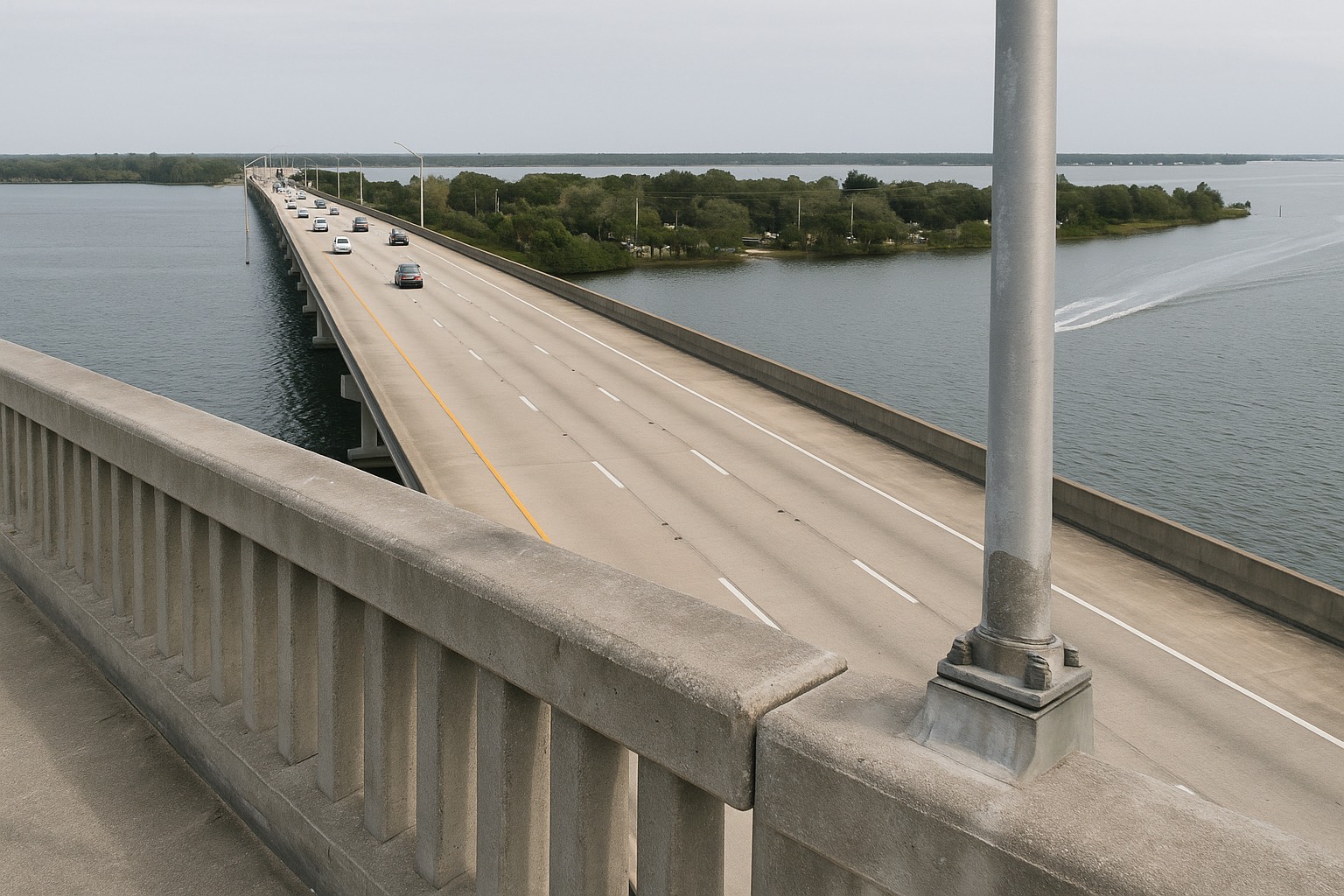
Four roads define how you move here. US 1 runs the length of town along the lagoon and is the spine, downtown, the riverfront parks, and most of the older housing stock hang off it. Interstate 95 runs several miles west, with the interchanges that connect Titusville to Orlando in one direction and to Cocoa, Rockledge and Melbourne in the other. SR 405, the NASA Causeway, is the southern crossing that carries workers from the mainland onto Kennedy Space Center, fed from the interstate by SR 407, the Challenger Memorial Parkway. SR 406, the Max Brewer Memorial Parkway, crosses the lagoon from downtown into the refuge, where SR 402 branches east toward Playalinda Beach.
Learn those four numbers before you shop. Which side of them a house sits on changes the daily experience more than the square footage does. You can see the whole arrangement on a map at Space View Park, the City of Titusville riverfront park that most locals use as the reference point for the crossing.
The one-line version
Titusville's view is permanent because the land across the water is federal, and the same federal presence is what closes roads, fills parking, and limits where anything new can be built. The asset and the friction are the same object.
Launch day on the ground: closures, crowds, noise
A launch is a regional event that lands on a small town. Here is what changes on the ground when one is on the schedule.
Traffic and parking. The riverfront in Titusville is one of the closest publicly accessible viewing lines to the Kennedy Space Center pads, so on a high-profile launch the parks along US 1 fill, on-street parking downtown fills, and the approaches back up. For an ordinary overnight cargo launch you may notice nothing at all. For a crewed mission or a first flight of a new vehicle, plan your errands around it. This is a real quality-of-life variable if you buy within a few blocks of the water, and a non-issue if you buy west of the interstate.
Road and beach closures. The National Park Service closes Playalinda Beach and portions of Canaveral National Seashore for certain launches, and the refuge posts its own closures on Black Point Wildlife Drive and the SR 402 and SR 406 corridors. Those are published: check the Canaveral National Seashore and Merritt Island National Wildlife Refuge alert pages on the morning of the attempt, because launch dates slip constantly. Past the security gate on the NASA Causeway, access is badge or ticket only; that stretch is never a public shortcut.
Noise. Two separate sounds, and buyers usually only think about one. The launch itself arrives as a low rumble that builds and rolls across the lagoon; from Titusville it is loud enough to feel in your chest on a large vehicle and unremarkable on a small one. The second sound is the one nobody warns you about: boosters returning to the landing zones at Cape Canaveral Space Force Station come back through the sound barrier, and the resulting sonic booms are sharp, doubled, and completely indifferent to the hour. They rattle windows. If you are a light sleeper, that is the downside of this town, and you should sit with it rather than assume you will adapt.
| Corridor or place | Who controls it | What to check before launch day |
|---|---|---|
| SR 405, NASA Causeway (east of the gate) | NASA, Kennedy Space Center | Badge or ticketed access only past the security gate. Never treat it as a through route. |
| SR 406 / SR 402 to Playalinda | National Park Service and U.S. Fish and Wildlife Service | Launch-day closures for the seashore and the refuge, posted on the agencies' own alert pages. |
| US 1 and the downtown riverfront | City of Titusville and Florida DOT | Viewing crowds and parking saturation on high-profile launches. |
| I-95 and SR 407 | Florida DOT | The western approach most commuters use; least affected by viewing traffic. |
Corridor control summarized from NASA Kennedy Space Center, the National Park Service (Canaveral National Seashore), the U.S. Fish and Wildlife Service (Merritt Island National Wildlife Refuge), the City of Titusville, and the Florida Department of Transportation, as of August 2026. Closure practice varies by mission: confirm with the managing agency before each launch.
The commute to KSC, the Cape and Patrick
I will not hand you a minute count, because your number depends on your gate, your badge, your shift and the day. What I will give you is the method, and it is the same method I use with every relocation into north Brevard.
Drive it twice, at your real hours. Once inbound at your actual start time, once outbound at your actual end time. Shift work at Kennedy Space Center and Cape Canaveral Space Force Station does not follow ordinary rush hour, and a route that is empty at six in the morning can be a different road at four in the afternoon. Map it yourself with a live traffic app on the days you would really be driving.
Understand the gate before the address. Two Titusville houses a mile apart can have meaningfully different drives depending on whether your work entrance is reached via SR 405 and the NASA Causeway or from the south through Merritt Island on SR 3. Ask your employer which gate your badge uses before you shop, then let that answer choose your search area. This one question saves more commuting grief than any other piece of advice on this page.
Be realistic about the southern jobs. Titusville sits at the top of the county. If your work is at Patrick Space Force Base, or in the Melbourne employment core, you are driving the length of Brevard twice a day, most of it on I-95 or US 1. People do it. Some keep doing it for years and some give it up quickly, which is exactly why you drive it at your real hours before you buy. If the Cape is your workplace, Titusville and Merritt Island homes for sale are both in range; if Melbourne is your workplace, be honest that north Brevard is the wrong end of the county for you and look at how the drive compares from every Space Coast city before you commit.
One more practical note. Titusville has its own general-aviation field, Space Coast Regional Airport, operated by the Titusville-Cocoa Airport Authority, which matters if you fly yourself or if your role involves frequent travel out of Orlando. For commercial flights out of Orlando International, the usual run is I-95 south to SR 528, the Beachline, which is a toll expressway rather than an interstate, and again, drive it once at the hour you would really be leaving before you decide anything.
Brianna's take
When a space-industry client calls me, my first question is never about bedrooms. It is which gate they badge through and what shift they work. Everything else: school attendance zone, flood zone, the block, the budget, sorts itself out once we know the drive. Test the commute first. The house is the easier problem.
What the refuge and the seashore mean for land
North Brevard is unusual in Florida for one reason: a very large share of the land nearby cannot be developed by anyone, ever. Merritt Island National Wildlife Refuge overlays Kennedy Space Center property under a long-standing arrangement between NASA and the U.S. Fish and Wildlife Service, and the National Park Service describes Canaveral National Seashore as the longest undeveloped stretch of Atlantic coast in Florida. Directly east of Titusville, across the lagoon, there is no private residential land to buy, the residential part of Merritt Island begins well to the south.
That has three consequences a buyer should hold at once.
- The view is protected by federal ownership rather than by a zoning ordinance. Zoning changes. A national wildlife refuge and a national seashore are a different order of permanence. If a protected sightline is why you are buying, this is the strongest version of that promise available in Brevard County.
- New construction has to go west and south. With the east side closed, growth pressure in north Brevard runs toward the I-95 corridor and down toward Port St. John and Cocoa. If you want a newer house here, that is where you will find most of it, and it is a very different setting from the older blocks near the water.
- Habitat rules can reach a specific parcel. The Florida scrub-jay is protected under the federal Endangered Species Act and administered by the U.S. Fish and Wildlife Service, and north Brevard holds scrub habitat. On some vacant land, a survey or a federal permit can precede clearing. If you are buying a lot to build on rather than an existing house, ask the City of Titusville planning department and the U.S. Fish and Wildlife Service what applies to that exact parcel, in writing, during your due-diligence period. Never assume a lot is buildable because it is for sale.
The refuge is also, plainly, the amenity. Black Point Wildlife Drive, the manatee observation deck at Haulover Canal, and the beach at Playalinda are all within a short drive of downtown, and you can see the scale of the protected area at the refuge boundary on the map. Gate hours, seasonal closures and launch closures apply, which is a fair trade for having a national wildlife refuge as your neighbor.
Buying near the water on the launch side
The blocks with the view are the blocks nearest the Indian River Lagoon, and the lagoon is a floodplain conversation. Do not let the sightline distract you from the four numbers that set your carrying cost.
Flood zone. Pull the address at the FEMA Flood Map Service Center and read the zone and the Base Flood Elevation. Zones are parcel-specific in Titusville: two houses on the same street can differ, and the answer determines whether a federally backed mortgage triggers a mandatory flood policy. I walk through reading those designations in the Space Coast flood-zone breakdown.
Wind and flood as separate policies. Flood is excluded from every homeowners policy in Florida and is bought separately through the NFIP or a private carrier. Wind sits inside the homeowners policy with its own hurricane deductible. Mainland Titusville is not the barrier island, and the exposure profile is different, but "different" is not "irrelevant", get real quotes while your insurance contingency is alive. The wind-versus-flood explainer lays out how the two policies meet.
Taxes and the assessed value. Pull the parcel at the Brevard County Property Appraiser and read the assessed value against the market value, then look at what the seller is paying now versus what a new owner would pay after the sale resets the assessment. Homestead and the Save Our Homes cap change that math substantially for a primary residence; I cover it in the homestead and Save Our Homes guide, and the county-level mechanics live in the Brevard property-tax walkthrough.
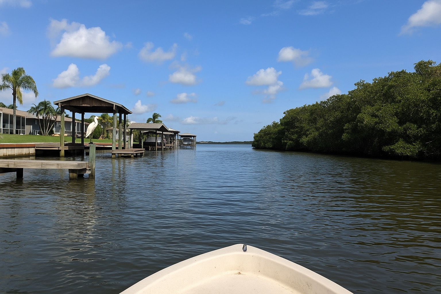
Seawalls, docks and lagoon permitting. If there is a seawall or a dock, have it inspected as its own line item and ask for the permit history. Work in and along the lagoon can involve the St. Johns River Water Management District and the local permitting authority, and an unpermitted structure becomes your problem at closing, and the seller is gone.
Housing stock here skews older and mainland: mid-century single-story homes on generous lots near US 1 and the downtown grid, with newer subdivisions further west toward the interstate. That is a different product from the condo stock on the barrier island, and it is worth understanding the trade before you choose a side of the county; the beachside-versus-mainland comparison is the piece I send buyers first. Current inventory and pricing move week to week, so read them live on the Titusville listings and the Titusville market report rather than from anything written months ago.
What I tell space-industry relocations
Most of my north Brevard buyers arrive because of a job on the Space Coast, and the launch cadence is why the job exists. That is worth saying plainly: this is a company town in the best sense, tied to NASA, the U.S. Space Force, and the contractors that support both. It has been through the cycles that implies. Anyone who lived here through the end of the Space Shuttle program will tell you what a slow period feels like in north Brevard. I will say it plainly: a local economy anchored to federal programs moves with those programs.
Here is the sequence I recommend, in order.
- Confirm the gate and the shift before you look at a single house, then test the drive at your real hours.
- Rent for a launch cycle if you can. Living through several launches and at least one middle-of-the-night booster return tells you more than any showing will. If a boom in the small hours is a dealbreaker, better to learn it as a tenant.
- Check the attendance zone at the source. Brevard Public Schools publishes the school locator and the zone boundaries; enter the specific address and confirm with the district, because zones are redrawn and a listing remark is not authoritative.
- Price the whole carrying cost. Principal and interest, the reset property tax, homeowners, flood if the zone requires it, and any association dues, added up as one monthly number before you make an offer.
- Read the town on an ordinary Tuesday. Launch day is the exception. The other three hundred and fifty days are the thing you are buying.
If you are weighing Titusville against the rest of the county, start with the town-by-town decision guide and the relocation overview for the Space Coast, then come back to what this town specifically offers. For a closer look at what a budget buys on the mainland here, the Titusville value breakdown is the companion piece to this one, and the crossing itself is covered in the Merritt Island causeway commute guide. You can trace the NASA Causeway approach at its western end near Titusville to see how the route runs on the ground.
Frequently asked questions
Can you see rocket launches from Titusville?
Yes. Titusville sits on the west bank of the Indian River Lagoon directly across open water from NASA's Kennedy Space Center, with Cape Canaveral Space Force Station beyond it, and nothing is built in the gap because the far bank is federal land held as Merritt Island National Wildlife Refuge and Canaveral National Seashore. The riverfront parks along US 1, including Space View Park, are among the closest publicly accessible viewing lines to the Kennedy Space Center pads. Visibility on any given launch still depends on weather, the launch azimuth and the time of day.
How loud are launches in Titusville, and do sonic booms rattle houses?
There are two different sounds. The launch itself arrives across the lagoon as a low building rumble that you feel as much as hear on a large vehicle, and that is often unremarkable on a smaller one. The second sound is the sonic boom from boosters returning to the landing zones at Cape Canaveral Space Force Station, which is sharp, usually doubled, and arrives at whatever hour the mission profile dictates, including the middle of the night. Booms do rattle windows in Titusville. If you sleep lightly, treat that as the downside of this town rather than something you will simply get used to.
Do launches close roads in Titusville?
Some of them do, and the closures are published by the agencies that control the land. The National Park Service closes Playalinda Beach and portions of Canaveral National Seashore for certain launches, and the U.S. Fish and Wildlife Service posts closures affecting Black Point Wildlife Drive and the SR 402 and SR 406 corridors into Merritt Island National Wildlife Refuge. Past the security gate, the SR 405 NASA Causeway is badge or ticket access only and is never a public through route. Check the managing agency's own alert page the morning of a launch, because dates slip frequently.
How long is the commute from Titusville to Kennedy Space Center?
It depends on which gate your badge uses and what shift you work, so drive it yourself rather than trusting an average. Take the route inbound at your real start time and outbound at your real end time, on the days you would really be driving, using a live traffic app. Two Titusville houses a mile apart can have meaningfully different drives depending on whether the entrance you use is reached by SR 405 and the NASA Causeway from the mainland or from the south through Merritt Island on SR 3. Ask your employer which gate you badge through before you choose a search area.
Is Titusville a reasonable base if I work at Patrick Space Force Base?
It is a long daily drive. Titusville sits at the northern end of Brevard County and Patrick Space Force Base is far to the south on the barrier island, so the commute runs most of the length of the county on Interstate 95 or US 1, twice a day. Some keep doing it for years and some give it up quickly. If the Cape or Kennedy Space Center is your workplace, north Brevard is well positioned; if your work is at Patrick or in the Melbourne employment core, compare the drive from the southern and central cities before committing to Titusville.
What does the Merritt Island National Wildlife Refuge mean for Titusville property?
It means the land across the water cannot be developed, so the sightline from the Titusville side is protected by federal ownership rather than by zoning, which is a far stronger form of permanence. It also means growth pressure in north Brevard runs west toward the Interstate 95 corridor and south rather than east. On vacant land, federal habitat rules can reach a specific parcel, because the Florida scrub-jay is protected under the Endangered Species Act and administered by the U.S. Fish and Wildlife Service and north Brevard holds scrub habitat. If you are buying a lot to build on, ask the City of Titusville planning department and the U.S. Fish and Wildlife Service in writing what applies to that parcel before you close.
Do I need flood insurance in Titusville?
That is a parcel-by-parcel answer, and the city name has nothing to do with it. Enter the specific address at the FEMA Flood Map Service Center to read the flood zone and the Base Flood Elevation, and if the property sits in a high-risk zone a federally backed mortgage generally triggers a mandatory flood policy. Two houses on the same Titusville street can carry different answers because the lagoon shoreline and the ground beneath it vary. Flood is excluded from every Florida homeowners policy and is always bought separately through the National Flood Insurance Program or a private flood carrier, so get quotes while your insurance contingency is still in place.
What should a space-industry relocation check before buying in Titusville?
Confirm which gate your badge uses and what shift you work, then drive the commute at your real hours before looking at houses. Rent through a launch cycle if your timing allows, so you experience several launches and at least one middle-of-the-night booster return before you own the house. Confirm the school attendance zone directly with Brevard Public Schools using the address, pull the parcel at the Brevard County Property Appraiser to see the assessed value against the market value and what the tax resets to after a sale, and add principal, interest, the reset tax, homeowners, flood and any dues into one monthly carrying number before you make an offer.
Keep reading
Thinking about north Brevard for a launch-industry move?
Tell me which gate you badge through and what shift you work, and I will tell you which Titusville blocks make sense and which ones will make you resent the drive. I have served Space Coast clients since 2015, and I would rather talk you out of the wrong street than sell you the view.
Data last verified: August 2026. Land, access and closure points summarized from NASA Kennedy Space Center, the United States Space Force, the National Park Service (Canaveral National Seashore), the U.S. Fish and Wildlife Service (Merritt Island National Wildlife Refuge), the City of Titusville, and the Florida Department of Transportation. Flood, tax and school points from the FEMA Flood Map Service Center, the National Flood Insurance Program, the Brevard County Property Appraiser, the Brevard County Tax Collector, and Brevard Public Schools, as of August 2026. Launch schedules, closures, flood zones, assessments and attendance boundaries change, confirm current specifics with the managing agency, a licensed Florida insurance agent, and the district before you rely on them.
Categories
- All Blogs (48)
- Cost of Living (3)
- Cost of Ownership (25)
- Decision Guide (9)
- Living in Cape Canaveral (8)
- Living in Cocoa Beach (5)
- Living in Melbourne (4)
- Living in Melbourne Beach (5)
- Living in Palm Bay (4)
- Living in Rockledge (3)
- Living in Satellite Beach (6)
- Living in Titusville (6)
- Living in Viera (4)
- Living on Merritt Island (4)
- When Buying (4)
- When Relocating (7)
Recent Posts