Buying Seaward of the Coastal Construction Control Line
Buying Seaward of the Coastal Construction Control Line
On the barrier island, the state has a say in what you build before your architect does, and almost nobody explains that line to you until after you own the house.
Two oceanfront houses on the same street, listed weeks apart, at close to the same price. On one of them you can add a second story, screen the pool, and rebuild the deck on a new footing. On the other you can own it, live in it, insure it, and mostly leave it alone. Nothing in either listing tells you which is which, and the survey most buyers get does not answer it either. The difference is a line the State of Florida drew across the beach, and if you are shopping oceanfront in Melbourne Beach or Satellite Beach, that line is what decides how much of the house is yours to change.
It is called the coastal construction control line, and it gets confused with a setback, a flood zone, and an erosion line. It is none of those. Here is what it does, why Brevard County has a second one hiding underneath it, what still needs a permit and what does not, and how to check any address yourself before you write an offer.
What the coastal construction control line is
The Florida Department of Environmental Protection sets a coastal construction control line county by county under Section 161.053, Florida Statutes. Lines are established in 25 of Florida's sandy-beach counties, and Brevard is one of them, which is why the control line turns up inside the county's own land development code and inside the beachside cities' codes, not just in a state file in Tallahassee.
DEP is direct about what the line is for. In its Homeowner's Guide to the CCCL Program, the department calls it "a line of jurisdiction, defining the landward limit of the Department's authority to regulate construction," and adds that control lines "should not be confused with setback lines or lines of prohibition."
Where it falls is engineering rather than zoning. The department describes the control line as the landward limit of significant damage to upland structures from the water forces of a one-hundred-year coastal storm, drawn from historical storm data, tide cycles, offshore bathymetry, erosion trends, upland topography, and the vegetation and structures already there. Seaward of it, the state expects a building to take a beating, so it wants a look at the building.
Seaward of the control line, you are not forbidden from building. You are required to ask.
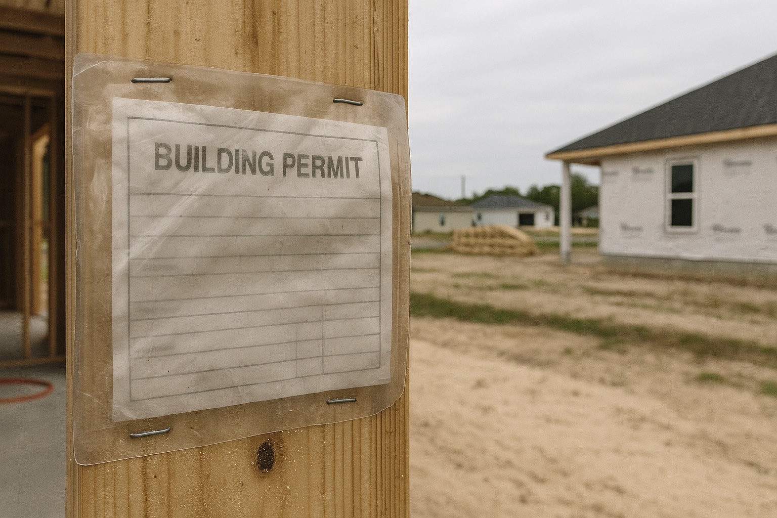
That distinction is the whole thing. New construction, additions, remodeling, and repairs are all permitted seaward of the line, but unless the work is exempt by rule or law, it needs a CCCL permit from DEP on top of your local building permit. Major structures also have to be sited far enough landward of the beach and frontal dune to let the shoreline move naturally, and designed to resist a one-hundred-year storm event under Section 3109 of the Florida Building Code, with a Florida-registered engineer or architect certifying that to the local building official.
Why the standard exists, in one comparison
DEP publishes a number from Hurricane Opal in 1995 that is worth carrying into a showing. In the department's own words, of the 1,992 major habitable structures the storm impacted, "768 (or 40%) were destroyed," while of the 576 structures permitted through the CCCL program and built to its standards, "only 2 (or 0.2%) were destroyed." Opal came ashore in the Panhandle rather than on this coast, but the standard it tested is the standard a Brevard permit applies. The department also makes a point buyers rarely hear: being inside CCCL jurisdiction does not impair your ability to insure the property, and federal flood insurance premiums recognize state coastal construction standards.
On the Space Coast there are two lines, and the town limit decides which one you get
Here is the part a state-level explainer will never tell a Brevard buyer: the state line is not the only one on the beach. Brevard County drew its own, and the county's line works the opposite way, it prohibits rather than permits.
Under Chapter 62, Article XII of the Brevard County Code of Ordinances, the county established a coastal setback line described as "a line 25 feet west by perpendicular measurement from a line previously described in Brevard County Survey Book 2A, pages 15, 28 (also known as the 1981 FDEP Coastal Construction Control Line)." Article XII governs property in the unincorporated area of the county.
Seaward of that county setback line, section 62-4212 prohibits new major habitable structures and new major accessory structures outright, and prohibits all excavation, digging, dredging, filling, drilling, cutting, scooping, or hollowing out. The section carves out only a short list: FDEP-permitted sandbag systems for structures the county has declared vulnerable, beach renourishment, beach restoration and dune restoration projects, and rigid coastal and shore-protection structures approved by the board of county commissioners under an emergency amendment to the comprehensive plan. And the county's definition of a "major accessory structure" is wider than most buyers assume. It includes swimming pools, bathhouses, detached garages, utility buildings, septic tanks and their drainfields, parking areas, impervious paved areas, utility lines, storm drains, private roads, and underground storage tanks.
What you may put seaward of that line is small and specific. Section 62-4213 allows detached minor structures that are pole-supported and elevated, with a floor between three and ten feet above natural grade, a maximum total height of twenty feet, no more than 100 square feet combined, and at least fifteen feet from the dune crest. Attached minor structures must be pole-supported or cantilevered, with a floor at least eight feet above natural grade, extending no more than ten feet seaward of the main structure. Beach access structures: boardwalks, walkways, stairways, are capped at five feet wide and may not run parallel to the shore. And native dune vegetation seaward of the 1981 line "shall not be removed."
Melbourne Beach: same ZIP code, two rulebooks
This is where the county boundary stops being trivia. As the Melbourne Beach guide lays out, there are two Melbourne Beaches. There is the incorporated Town: about 1.3 square miles at the north end, the historic grid around Ocean Avenue and Ryckman Park. Then there is everything the 32951 ZIP covers south of the town line, down A1A through Melbourne Shores, Floridana Beach, and Aquarina, and that stretch is unincorporated Brevard County.
An oceanfront parcel south of the town line answers to county Article XII. An oceanfront parcel inside the Town does not. Same ZIP code, same highway, same beach, different rules about what you can put behind the house. If you are comparing two listings a few miles apart on A1A, confirm which side of the town line each one sits on before you compare them on anything else.
Satellite Beach: an incorporated city writes its own
Satellite Beach has been an incorporated city since 1957, so county Article XII does not reach it. The city keeps its own coastal construction control line standards and criteria in Chapter 30, Article VII, Division 4 of the Satellite Beach Code of Ordinances, with its own design standards and its own variance route through the Board of Adjustment. Those are city questions, answered by Community Development, not by the county.
And the same city-limit trap sits immediately north. South Patrick Shores carries a Satellite Beach mailing address and shares the 32937 ZIP, but it is unincorporated Brevard County, which the Satellite Beach guide covers in more detail. A mailing address is not a jurisdiction. On the beach side, that difference decides which code book governs your pool cage.
| Line | Who draws it | What it controls | Where it applies |
|---|---|---|---|
| State coastal construction control line | Florida DEP, under s. 161.053, F.S. | Whether DEP must permit construction, excavation, and dune vegetation removal seaward of it | 25 sandy-beach counties, Brevard included: the full oceanfront |
| Brevard County coastal setback line | Brevard County, Code ch. 62, art. XII | Prohibits new major habitable and major accessory structures, and all excavation, seaward of it | Unincorporated Brevard only: including the 32951 stretch south of Melbourne Beach |
| City and town codes | Satellite Beach, Town of Melbourne Beach, and the other beach municipalities | Local coastal construction standards, dune protection, beachfront lighting, building permits | Inside each municipality's limits |
| FEMA flood zone | FEMA, on Flood Insurance Rate Maps | Whether flood insurance is required, what it costs, and floodplain construction rules | Every parcel, mapped separately from any control line |
What needs a DEP permit, and what is exempt
The hinge is usually excavation and the foundation. Work that stays inside what already exists tends to be exempt; work that digs, extends seaward, or touches the foundation tends not to be. DEP lists the exemptions in Rule 62B-33.004, Florida Administrative Code, and summarizes them in the homeowner's guide. Here is how the common oceanfront projects sort out.
| The work | Where it usually lands |
|---|---|
| New house, addition, or major remodel seaward of the line | CCCL permit required |
| A new swimming pool, or pool work that involves excavation | CCCL permit required |
| Maintenance or repair of an existing pool with no excavation, at least 30 feet landward of the frontal dune, escarpment, or armoring | Exempt |
| Remodeling that stays within the limits of the existing foundation and does not modify the foundation itself | Exempt: but seawalls, and any addition or enclosure below the first dwelling floor, are specifically excluded from this exemption |
| A new seawall or revetment | CCCL permit required, and only if the structure qualifies for armoring at all |
| Minor seawall maintenance: scraping, chipping, sandblasting, guniting, painting | Exempt |
| Repairs to a pile-supported foundation: bolts, hurricane straps, secondary members, shore-normal cross bracing | Exempt |
| Clearing windblown sand off a pool deck, patio, or walkway | Exempt if the general grade does not change and beach-quality sand goes back seaward of the line |
| Landscape planting at least 30 feet landward of the frontal dune, with no excavation and no native salt-tolerant vegetation removed | Exempt |
| Dune walkovers, decks, gazebos, sand fences | Depends on siting and elevation: and in unincorporated Brevard the county's own dimensional limits apply on top |
For projects sited well upland from the beach and away from sensitive dunes, DEP offers a general permit under Chapter 62B-34, which allows approval within 30 days of submittal and covers single-family houses, decks, garages, and similar work. Multi-family construction is not eligible. The department has also mapped "general permit lines" showing where that streamlined route is available, which show up as a blue line on its mapping site.
The 30-year erosion projection: the rule that stops a plan
There is a second state line, further seaward, that matters more than the control line if you are buying a vacant lot or a tear-down. DEP defines the 30-year erosion projection as the projected location of the seasonal high-water line on the property thirty years after a permit application is submitted. It is calculated from documented historical shoreline change for that stretch of coast, and the department will tell you where it falls. Where there are substantial seawalls, the projection stops at the seawall.
The consequence is blunt. No major structure is eligible for a CCCL permit seaward of the 30-year erosion projection, with two exceptions: coastal and shore-protection structures, and single-family dwellings that meet the specific siting requirements in Section 161.053(5), Florida Statutes. Those requirements include that the parcel was platted before the statute's effective date, that the owner does not own an adjacent parcel further landward, and that the dwelling be sited as far landward on its parcel as is practicable.
So a parcel can be seaward of the control line and be an ordinary permitting exercise, or be seaward of the 30-year projection and be a very different conversation. If your plan for a property is to build something new on it, ask DEP where the 30-year line falls on that parcel while your inspection period is still running, not after.
Rebuilding, repairs, and what happens after a storm
Buyers ask this one first, and the answer is better than they expect. DEP states it plainly: "There is no prohibition against rebuilding seaward of the CCCL."
Rebuilt structures generally have to meet the siting and design standards in Section 161.053 and Chapter 62B-33, though the statute allows some new-construction standards to be relaxed in certain circumstances. Repair, maintenance, or modification within the confines of the existing foundation, not involving the foundation itself, is exempt from permitting. An existing structure may be moved to a more landward location, or onto an improved foundation, as long as the move does not increase adverse impacts to the beach and dune system. A structure that is damaged, or that is being rebuilt for economic reasons, may be rebuilt within the confines of the existing foundation once it complies with the design standards. Seaward of the 30-year erosion projection, a destroyed structure may be rebuilt if the reconstruction is otherwise eligible for a permit, but it may not enlarge the capacity of the original.
Unincorporated Brevard adds a harder layer for structures already sitting seaward of the county setback line. Under section 62-4207, modification, maintenance, or repair of a nonconforming structure is allowed only if the work does not expand the structure further seaward, does not alter the foundation except as needed to meet current building code, and does not convert between habitable and accessory use. Any portion undermined by erosion has to be removed rather than repaired. Work on an undermined structure is not permitted closer than fifteen feet landward of the crest of the dune, and the finding that the seaward-most portion is set back far enough to avoid being undermined in a 25-year storm event has to be sealed by a professional engineer.
Do not assume a seawall is available to you
Armoring is not a default option. To be eligible for coastal armoring, the structure being protected must be either public infrastructure, a public evacuation route, an emergency facility, a hospital, or a private structure such as a nonconforming single-family home, and it must be vulnerable to direct wave attack or to erosion from a 15-year return-interval storm. DEP encourages owners to weigh foundation modification, relocating the structure, and dune restoration first, because armoring increases erosion on the beach in front of it and on the properties beside it. If a listing's long-term plan depends on a seawall, verify that the property qualifies before you rely on it.
The turtle rules that ride along with the line
South of Melbourne Beach, the CCCL stops being an abstraction and starts being the reason your neighbors' porch lights are amber. The Archie Carr National Wildlife Refuge was established in 1991 and is run by the U.S. Fish & Wildlife Service: 20.5 miles of beach and shoreline between Melbourne Beach and Wabasso Beach across Brevard and Indian River counties. The Service calls it the most significant area for loggerhead sea turtle nesting in the world and the most significant area for green turtle nesting in North America, and puts the refuge's annual count at 15,000 to 30,000 sea turtle nests. Undeveloped, dark beach is the point of it.
That shows up on your house in two places. First, as a condition of a CCCL permit: DEP's guidance states that "Tinted glass shall be used for windows and doors which are visible from the nesting areas of the beach," and that exterior lighting visible from the nesting beach is strongly discouraged, and must be shielded or designed not to disturb nesting turtles and hatchlings if it is proposed at all.
Second, through local ordinances that are older than most of the housing stock. According to the Florida Fish and Wildlife Conservation Commission's list of local lighting ordinances, Brevard County adopted its ordinance in 1985, the Town of Melbourne Beach in 1986, and the City of Satellite Beach in 1990, each amended since.
What the Town of Melbourne Beach code requires
The Town's rules sit in Chapter 40, Article II of its code. On new development, no point source of light or reflective surface of a fixture may be directly visible from the beach, and areas seaward of the frontal dune may not be directly, indirectly, or cumulatively illuminated. Acceptable exterior fixtures are completely shielded downlight-only or recessed fixtures with low wattage, 50 watts or less, mounted low. Decorative floodlights, uplights, and spotlights visible from the beach are prohibited. Parking-area fixtures may not be mounted higher than 48 inches. And tinted glass is required on all windows and glass doors of single or multi-story structures with line-of-sight of the beach. A night inspection at certificate of occupancy confirms the result.
For structures that already exist, the Town's remedies are repositioning fixtures, recessing or shielding them with opaque shields covering an arc of at least 180 degrees, swapping to yellow "bug" type bulbs not exceeding 50 watts, and using window tint, blinds, or curtains to keep interior light off the beach. From May 1 through October 31, nonconforming fixtures must be extinguished after 9:00 p.m., and any fixture that cannot be brought into compliance has to be permanently removed or permanently disabled. Brevard County's Chapter 46, Article III carries the same shape for unincorporated beachfront, including the same 9:00 p.m. cutoff during the May 1 to October 31 nesting season.
The practical translation for a buyer: on an oceanfront home here, the exterior fixtures, the glass, and the pool-deck lighting are regulated parts of the house, the way the roof and the windows are. If the property you are touring has bright white floodlights aimed at the dune, you are not looking at a feature. You are looking at a correction someone will have to make, and it may be you.
The construction calendar nobody prices in
CCCL permits carry standard conditions, and one of them quietly sets the schedule for any beach-side project. Rule 62B-33.0155, Florida Administrative Code, states that "The marine turtle nesting season is May 1 through October 31 in all counties except Brevard, Indian River, St. Lucie, Martin, Palm Beach, and Broward counties where leatherback turtle nesting occurs during the period of March 1 through October 31."
During that season, "no operation, transportation, or storage of equipment or materials is authorized seaward of the dune crest or rigid coastal structure," and no temporary lighting of the construction area is authorized at any time.
Read that against a Brevard calendar. Because leatherbacks nest here earlier than they do on most of the Florida coast, our restricted window runs eight months, from March 1 to October 31. Work that has to stage equipment seaward of the dune crest, a seawall, a dune walkover, a rebuild, has roughly four months to happen, from November through February. Miss the window and the project waits a year. If you are buying a barrier-island property with a plan attached, the plan has a season, and that season is short.
Note also that the two clocks do not match. The construction restriction on a CCCL permit starts March 1 in Brevard. The county and Town lighting seasons run May 1 to October 31. Same beach, two different calendars, and confusing them is how a contractor's schedule slips.
What the seller owes you at closing: and why you should not wait for it
Florida has a disclosure written specifically for this. Section 161.57, Florida Statutes, requires a seller to give a buyer of coastal property a written statement that the property may be subject to coastal erosion and to federal, state, or local regulation of coastal property, including the delineation of the coastal construction control line, rigid coastal protection structures, beach nourishment, and the protection of marine turtles. And unless the buyer waives it in writing, at or before closing on property located partially or totally seaward of the control line, the seller must provide an affidavit, or a survey meeting the requirements of chapter 472, delineating the location of the control line on the property.
That survey is the document your architect will want, because a mapping tool tells you which side of the line a parcel sits on and a survey tells you exactly where the line crosses the lot. But read the last part of the statute before you rely on it: a seller's failure to deliver the disclosure, affidavit, or survey does not impair the enforceability of the contract, create any right of rescission for the buyer, or impair title. The disclosure is your right. Chasing it inside your inspection period is your job, which is exactly the kind of thing I would rather handle for you before the deadline than explain after it.
How to check a specific address before you write
You can do most of this yourself in an evening, and you should, because it is far cheaper than finding out later.
1. Find the line. Start at DEP's Locate the CCCL page and open its Map Direct viewer, where the control line renders as a solid red line over aerial imagery. Zoom to the parcel and see which side it falls on. Treat it as a map, not a survey.
2. Check the flood zone separately. The control line and the flood zone are drawn by different agencies for different purposes. Look the parcel up at the FEMA Flood Map Service Center, then read our breakdown of Space Coast flood zones for what AE, VE, and X do to your insurance.
3. Pull the permit history. DEP keeps CCCL permits and file documents in OCULUS, its public document system. If the seawall, the pool, or the deck was built seaward of the line, there should be a record. If there is not, that is worth asking about.
4. Call the right government. For an address inside Satellite Beach, that is the city. For the Town of Melbourne Beach, the Town. For the unincorporated stretch south of the town line, or South Patrick Shores, that is Brevard County. Ask which lines apply to the parcel and what a permit takes.
5. Ask for the 161.57 affidavit or survey early. Request it during your inspection period, in writing, rather than letting it arrive at the closing table when there is nothing left to do with it.
Frequently asked questions
What is the coastal construction control line in Florida?
It is a line the Florida Department of Environmental Protection sets county by county under Section 161.053, Florida Statutes. DEP calls it "a line of jurisdiction, defining the landward limit of the Department's authority to regulate construction," and says control lines "should not be confused with setback lines or lines of prohibition." It marks the landward limit of significant damage to upland structures from the water forces of a one-hundred-year coastal storm. Lines are established in 25 of Florida's sandy-beach counties, Brevard among them. Being seaward of it does not mean you cannot build. It means the state has a say in what you build.
How do I find out if a property is seaward of the coastal construction control line?
Two ways, and you want both. First, look it up yourself: DEP publishes the line on its Map Direct viewer, reached from the department's "Locate the CCCL" page, where the control line appears as a solid red line over aerial imagery. That tells you which side of the line a parcel sits on, but it is a map, not a survey. Second, use the statute: under Section 161.57, Florida Statutes, unless you waive it in writing, the seller of property partially or totally seaward of the line must give you an affidavit or a survey delineating where the line falls on that property, at or before closing. Ask for it during your inspection period.
Can I still build or remodel on a property seaward of the line?
Yes. DEP's own homeowner guidance says new construction, additions, remodeling, and repairs to existing structures are all allowed seaward of the control line, but unless the work is exempt by rule or law, it needs a CCCL permit from the department before you proceed. Major structures also have to be sited far enough landward of the beach and frontal dune to allow natural shoreline fluctuation, and designed to resist a one-hundred-year storm event under Section 3109 of the Florida Building Code, certified by a Florida-registered engineer or architect. Projects sited well upland from the beach may qualify for a general permit, which DEP can approve within 30 days of submittal.
Do I need a CCCL permit to redo my pool deck or repair my pool?
Often not, and the deciding factor is usually excavation. Under DEP's exemptions, maintenance or repair of a swimming pool is exempt if it does not involve excavation and the pool sits at least 30 feet landward of the frontal dune, escarpment, or coastal armoring structure. Clearing windblown sand off a pool deck, patio, or walkway is also exempt if the general grade does not change and beach-quality sand is returned seaward of the line. Digging a new pool, extending a deck seaward, or rebuilding on a new footing is a different question. Ask DEP before your contractor mobilizes, not after.
If a storm destroys an oceanfront house, can it be rebuilt?
Usually, yes. DEP states that there is no prohibition against rebuilding seaward of the coastal construction control line. A damaged structure can generally be rebuilt within the confines of its existing foundation once it complies with the design standards, and an existing structure can be moved landward or onto an improved foundation as long as that does not increase impacts to the beach and dune system. The harder case is a home seaward of the 30-year erosion projection: it may be rebuilt if the reconstruction is otherwise eligible for a permit, but it may not enlarge the capacity of the original. In unincorporated Brevard County, the county code adds another rule, any part of a nonconforming structure undermined by erosion must be removed rather than repaired.
Is the county setback line the same as the state control line?
No, and on the Space Coast that difference is worth real money. Brevard County established its own coastal setback line under Chapter 62, Article XII of the county code, described as a line 25 feet west by perpendicular measurement from a line also known as the 1981 state coastal construction control line. Seaward of the county line, the code prohibits new major habitable and major accessory structures, a category that includes swimming pools, detached garages, septic tanks and drainfields, paved areas, and utility lines, and prohibits all excavation. Article XII applies to unincorporated Brevard County, which includes the 32951 stretch of A1A south of the Town of Melbourne Beach. Inside an incorporated city like Satellite Beach, the city's own code governs instead.
Why can't I put a floodlight on the back of an oceanfront house here?
Because the beachfront lighting rules on this coast are older and stricter than most buyers expect. The Florida Fish and Wildlife Conservation Commission's ordinance list shows Brevard County adopting its lighting ordinance in 1985, the Town of Melbourne Beach in 1986, and the City of Satellite Beach in 1990. Under the Town's code, decorative floodlights, uplights, and spotlights visible from the beach are prohibited on new development, and tinted glass is required on windows and glass doors with line-of-sight of the beach. On existing structures, nonconforming fixtures must be extinguished after 9:00 p.m. from May 1 through October 31, and a fixture that cannot be brought into compliance has to be permanently removed or permanently disabled. Brevard County's code carries the same 9:00 p.m. rule for unincorporated beachfront.
Does the control line have anything to do with my flood zone?
No, and confusing the two costs people money. Your FEMA flood zone determines whether flood insurance is required and what it costs. The coastal construction control line determines whether the state regulates what you build. They are drawn by different agencies, for different purposes, from different data. A parcel can sit seaward of the control line and still need its flood zone looked up separately at the FEMA Flood Map Service Center. Check both before you write an offer, and get an actual insurance quote while your contingencies are still in place.
Know what the property will let you do before you own it
Before you make an offer on an oceanfront home in Melbourne Beach or Satellite Beach, I will find where the state control line falls on that parcel, tell you whether the address is inside a city or in unincorporated county, pull the CCCL permit history, and get you the 161.57 survey while there is still time to use it. I have served Space Coast clients since 2015, and on the barrier island the question is never only what a house costs. It is what you will be allowed to do with it.
Keep reading
Data last verified: August 2026. Statutory, rule, and local-code references reflect Section 161.053 and Section 161.57, Florida Statutes, Rules 62B-33 and 62B-34, Florida Administrative Code, Brevard County Code chapter 62 article XII and chapter 46 article III, the Town of Melbourne Beach Code chapter 40 article II, and the Satellite Beach Code chapter 30 article VII division 4, as of August 2026. Control lines, ordinances, and permitting requirements change, and city and county jurisdiction varies parcel by parcel, confirm the current rules and the exact line locations for your specific property with the Florida Department of Environmental Protection and the local building department before you rely on any of it.
Categories
- All Blogs (48)
- Cost of Living (3)
- Cost of Ownership (25)
- Decision Guide (9)
- Living in Cape Canaveral (8)
- Living in Cocoa Beach (5)
- Living in Melbourne (4)
- Living in Melbourne Beach (5)
- Living in Palm Bay (4)
- Living in Rockledge (3)
- Living in Satellite Beach (6)
- Living in Titusville (6)
- Living in Viera (4)
- Living on Merritt Island (4)
- When Buying (4)
- When Relocating (7)
Recent Posts